LOCATION YEAR TYPE STATUS SIZE LATSIA 2011 PUBLIC SPACE COMPETITION 30.500sqm (park) CYPRUS 1.100sqm (indoor spaces)

ARCHITECTS DESIGN TEAM ZAPANTIOTIS FOTIS ZAPANTIOTIS FOTIS DASKALAKI KATERINA DASKALAKI KATERINA
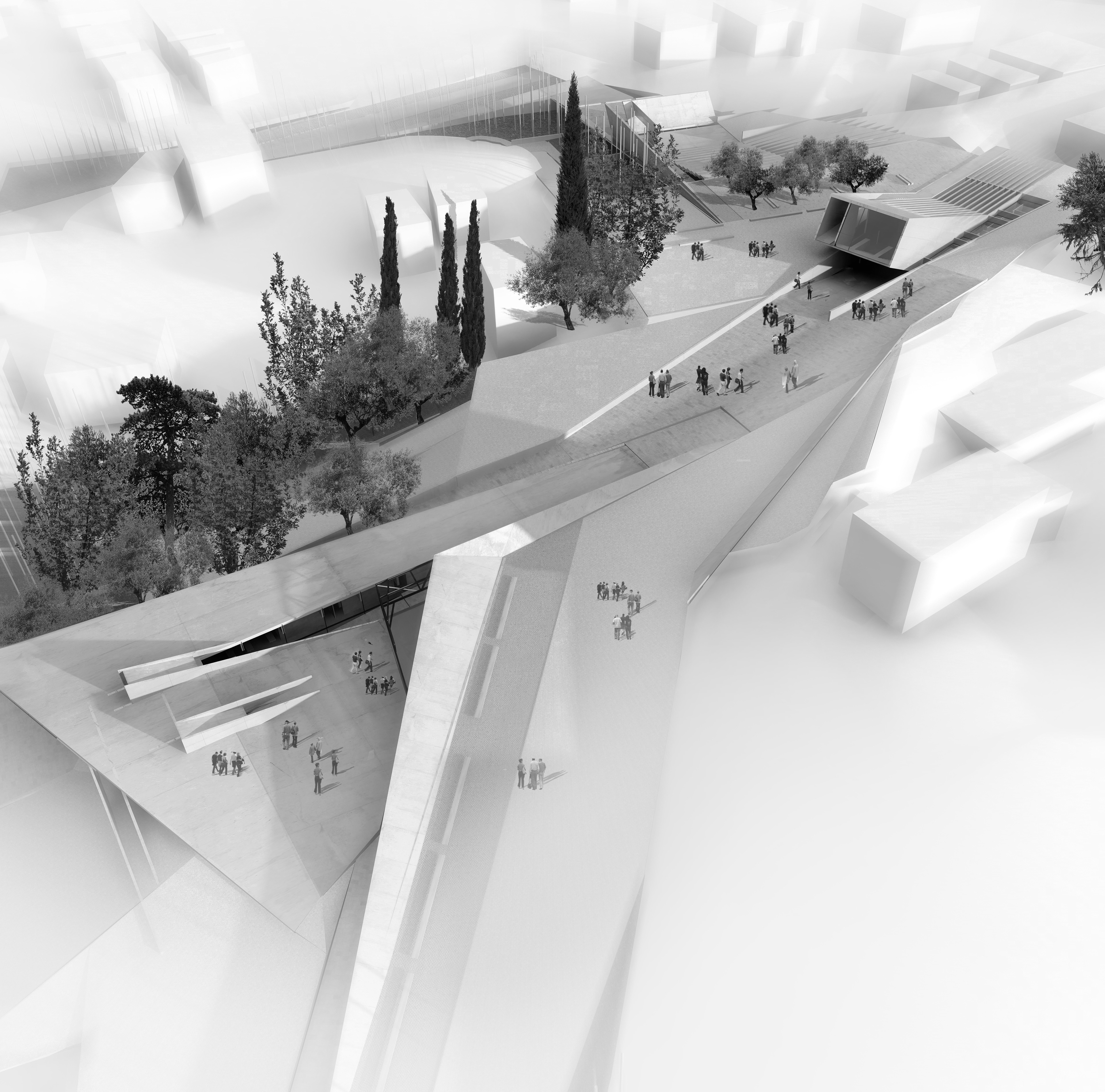
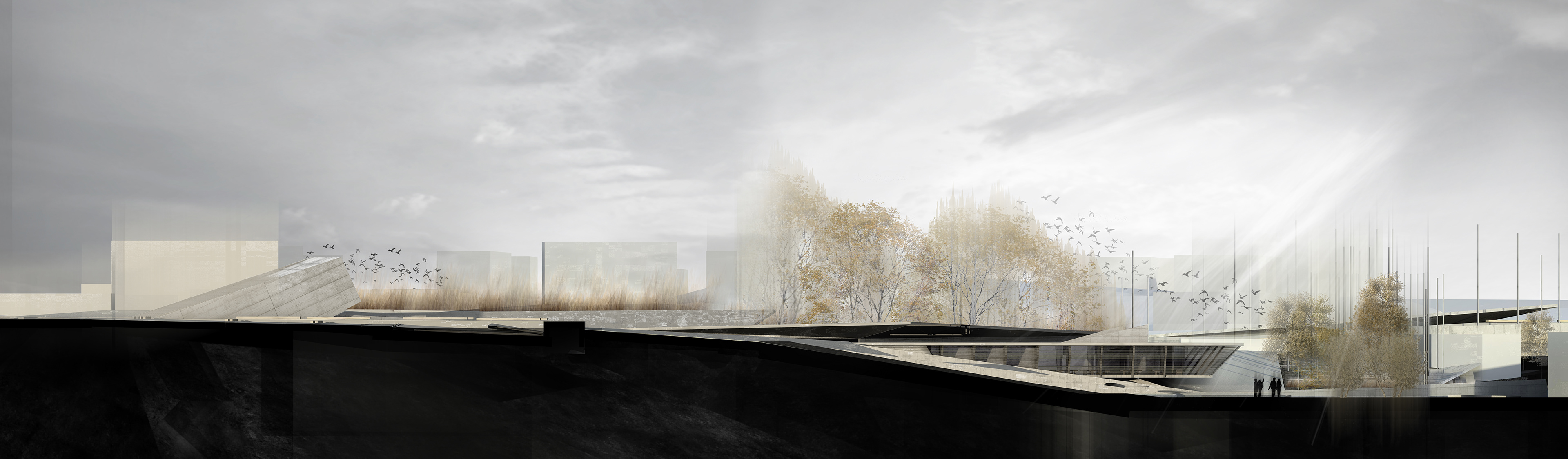
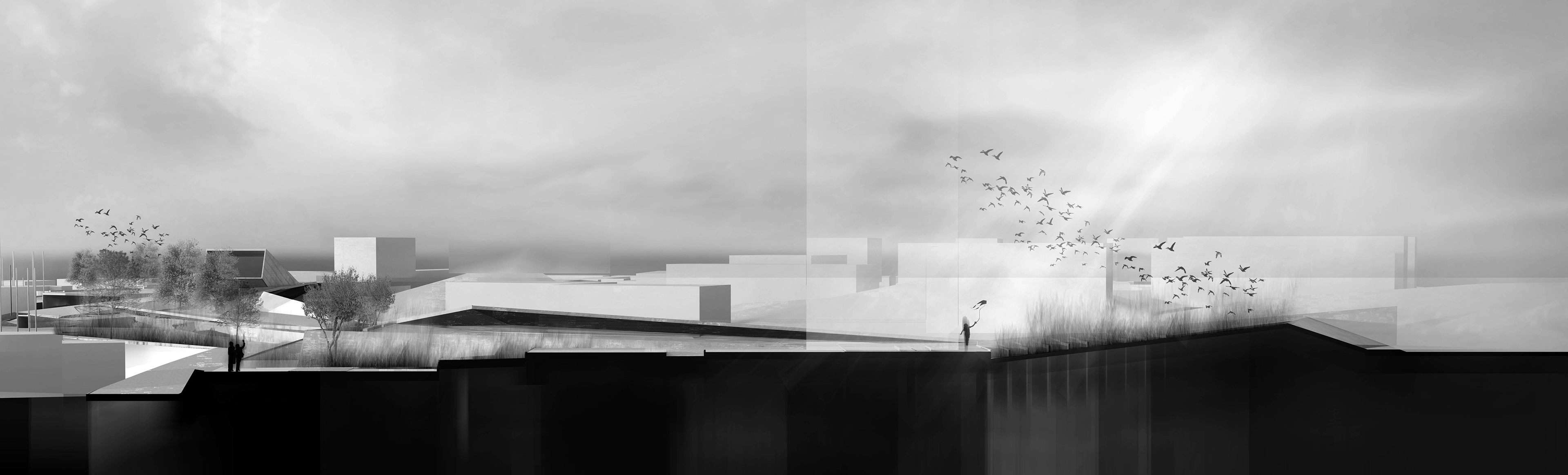
The park of Pallourokampos extends as an elongated buffer between the residential zone and the commercial traffic of Archiepiskopou Makariou III Street. In consequence, it is treated as the terminating point - crucible of the dynamic flows of the urban grid, in a way that activates it and brings it to the foreground as the organic extension of the city and its everyday life.
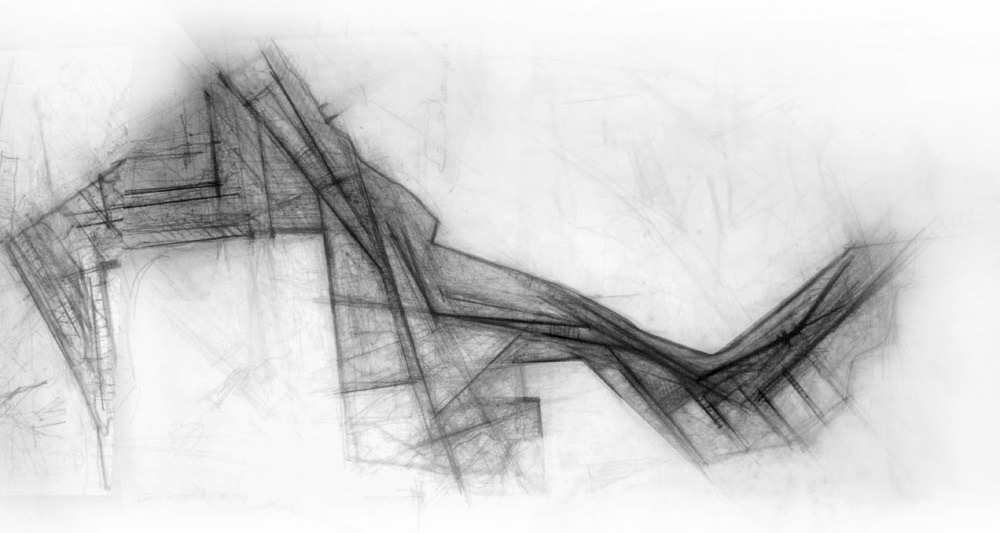
Reading the topography of the park resulted to the necessity to bring to the foreground the complexity of the geomorphological formations and of their rhythmical alterations (narrowness - opening, slope - flat area), interweaving them with the possible movements and resting points imposed by the landscape.
Reading the topography of the park resulted to the necessity to bring to the foreground the complexity of the geomorphological formations and of their rhythmical alterations (narrowness - opening, slope - flat area), interweaving them with the possible movements and resting points imposed by the landscape.
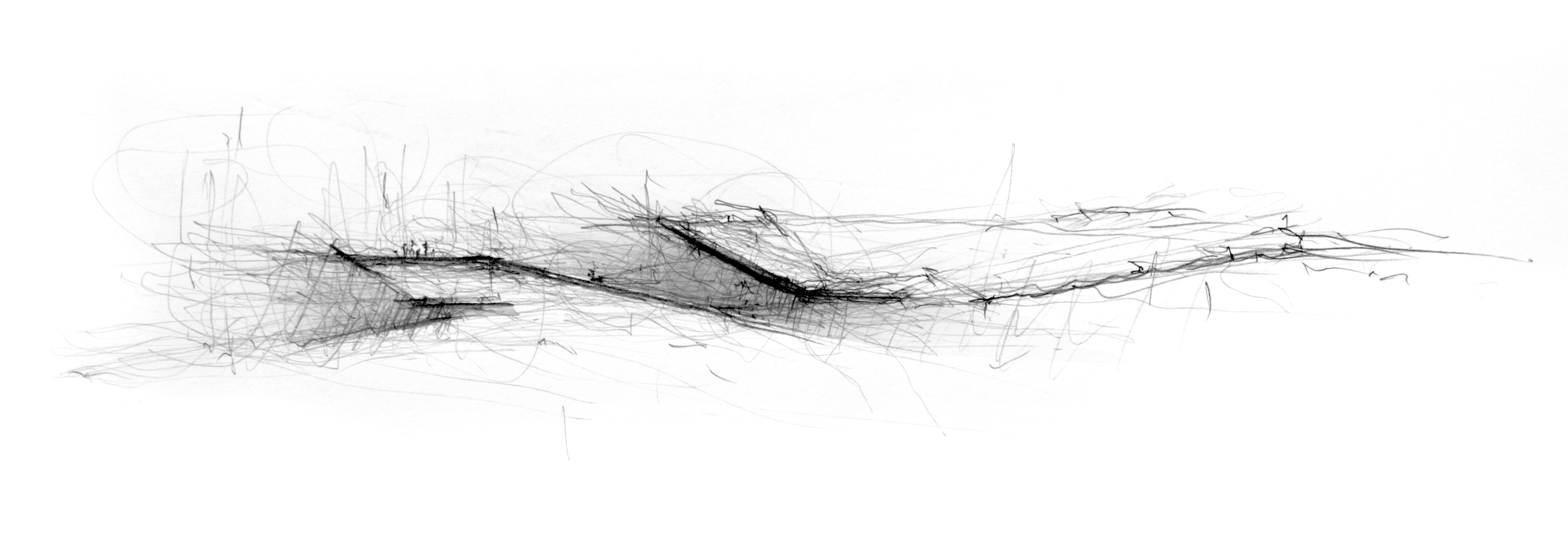
From the very beginning it became necessary to find the rule that would define the proposal and assist in overcoming the bewilderment felt before the completely natural, organic and unstructured environment, allowing transition to the anthropogenic and “organized” environment. In consequence, the grid incorporating the entire proposal was defined by following the lines of the ground’s morphology. All the parts of the proposal, including the classification and “settling" of earth have been subdued to the meter of a rhythm that predominated it and regulated its evolution.
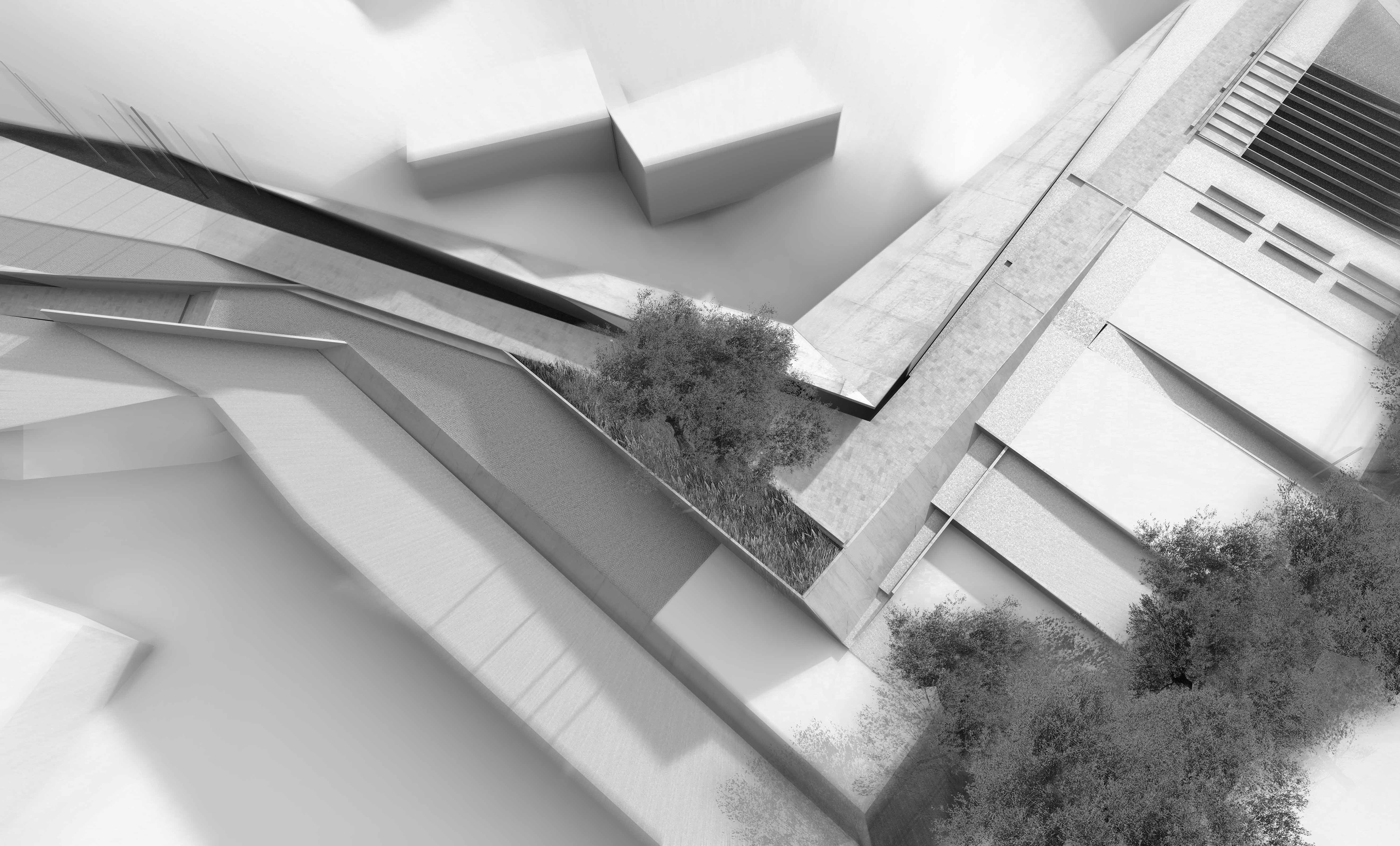
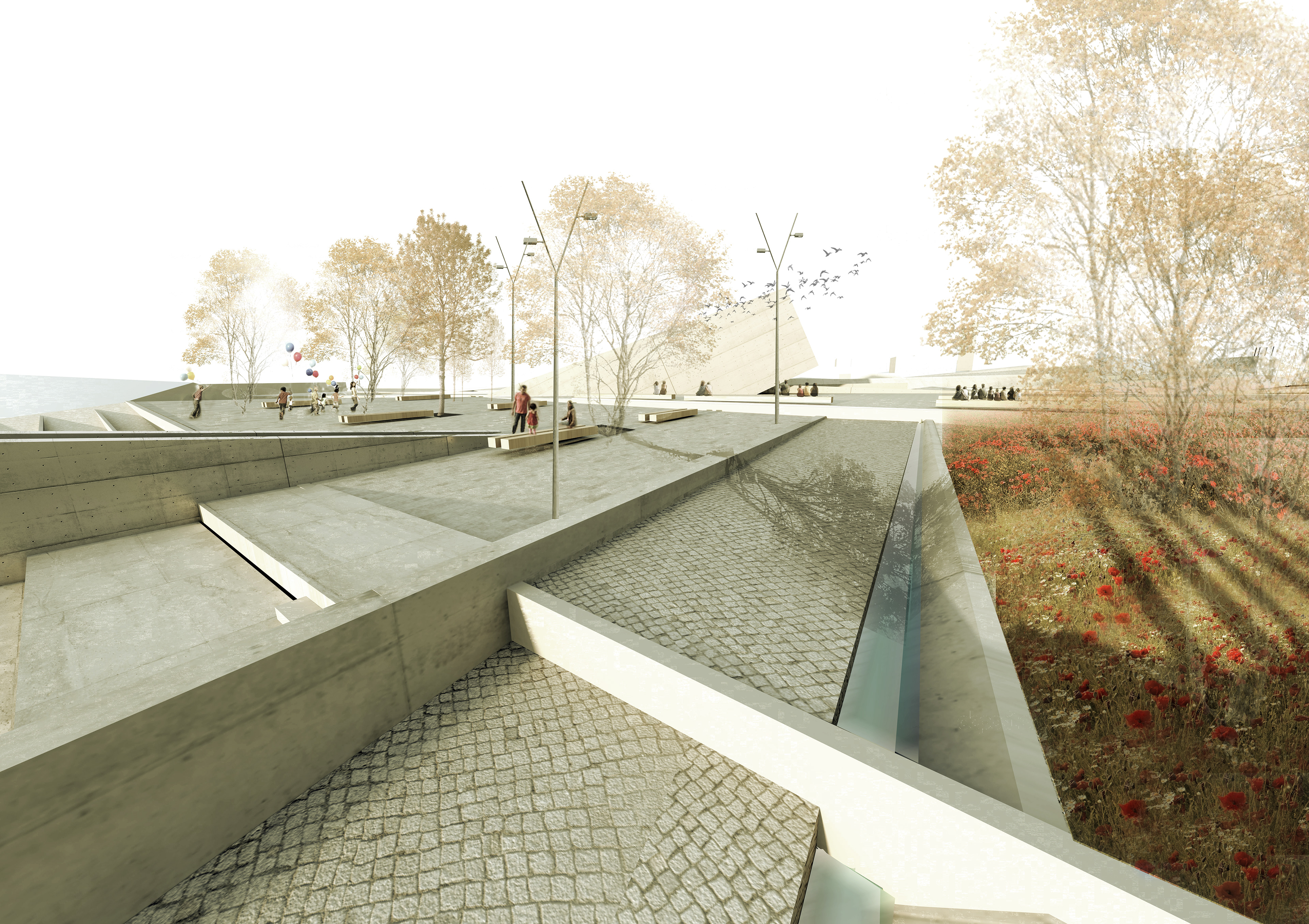
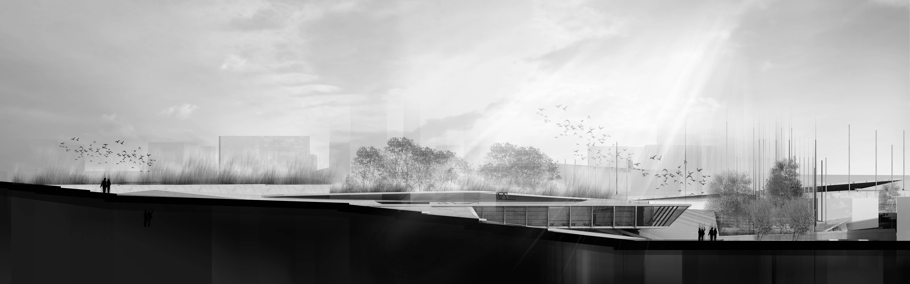
The basic geometrical characteristics of the landscape set the composite trace of the proposal, where the field could be further analysed as a backbone running along the park containing two open surfaces. As a result, the backbone serves as a peripheral artery supplying the heart at the centre of the solution and its surrounding areas. The backbone and the open surfaces, subjected to the rhythm of the pre-existing grid, are transformed to the main route, running across the park and the resting, meditation, communication, and reflection areas interspersed over it.
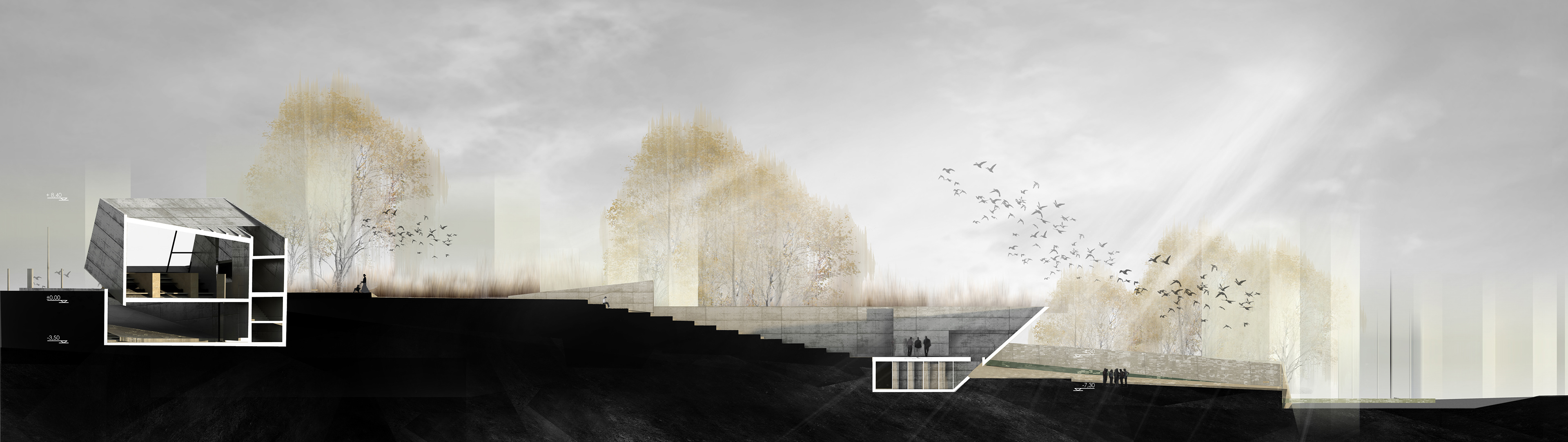
The route on the backbone of the park is accompanied by the sound of water flowing inside dikes. Rainwater is gathered in pits placed at the nodal areas of the park. As a result, the water defines the heart of the solution, showcasing the surrounding character of the flat areas, while improving the entire area's microclimate.
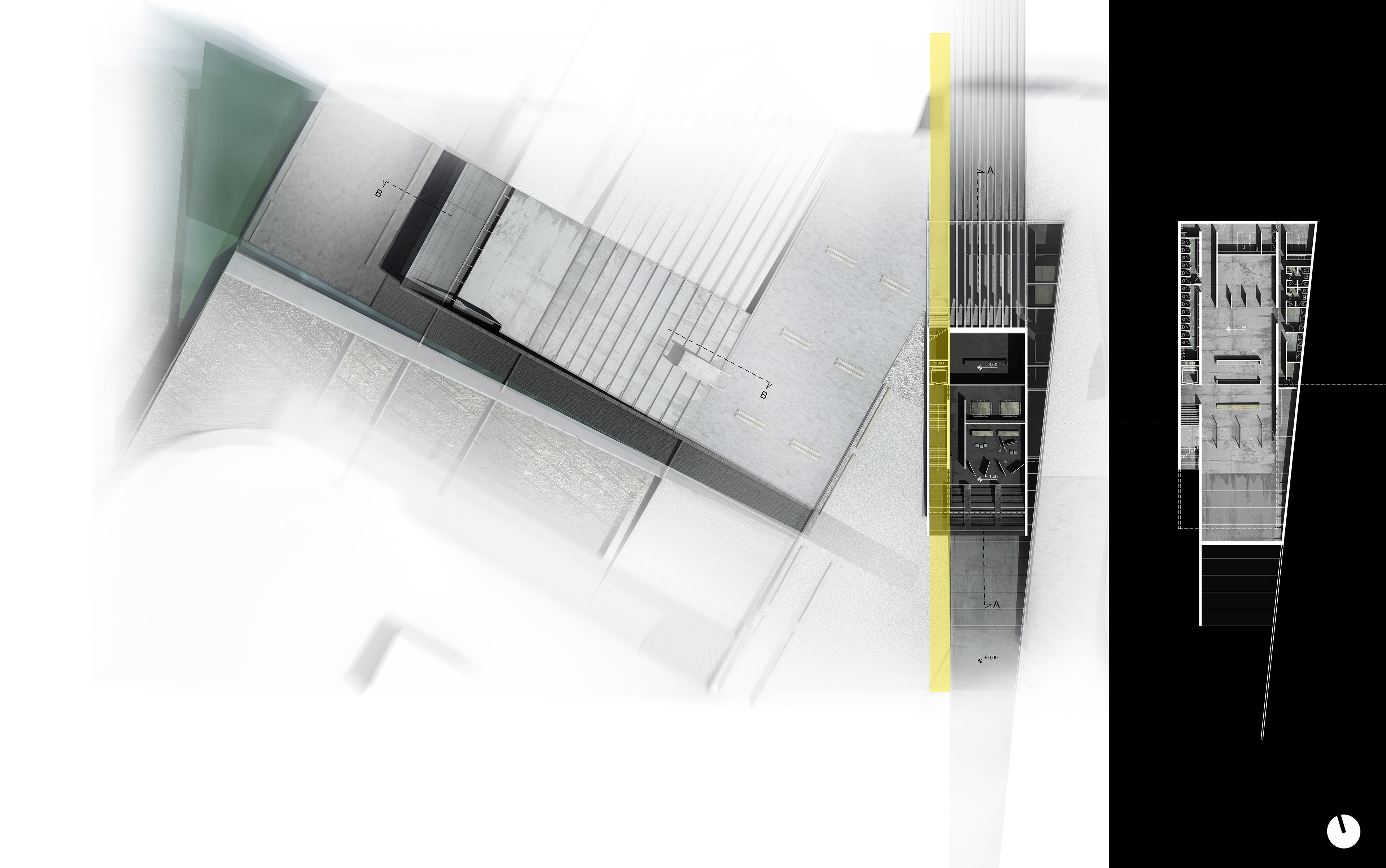
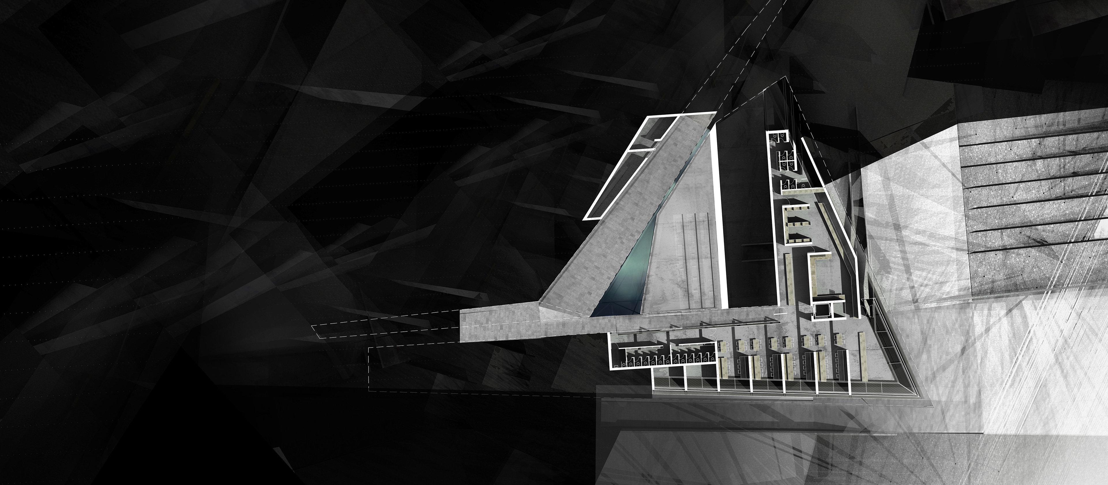
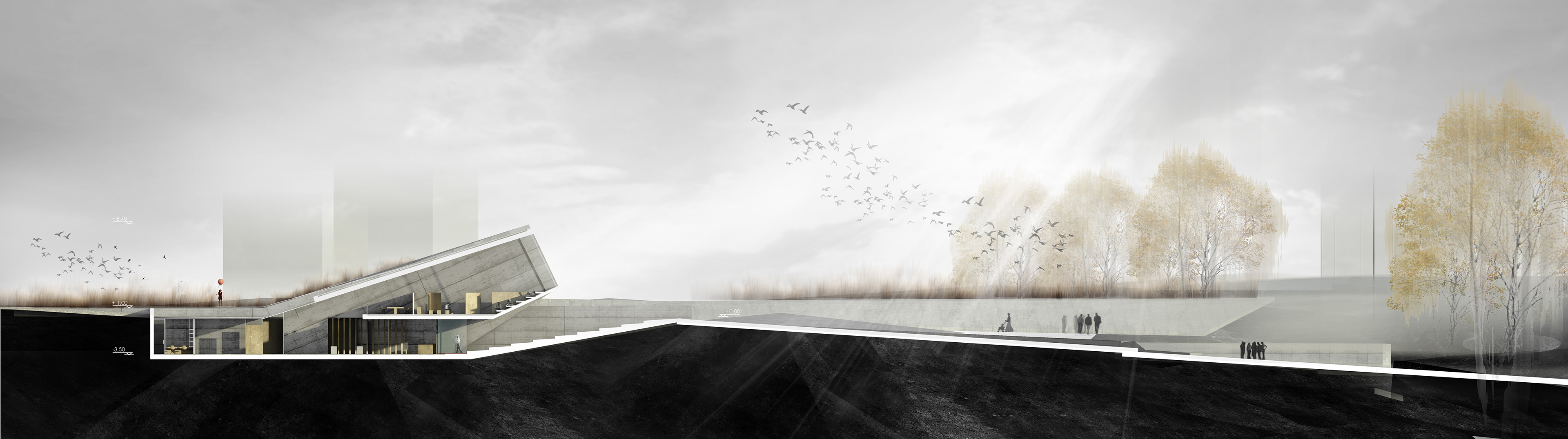
The movement - resting network, in combination with the morphology of the ground, set the locations of the buildings either away from the centre, as peaks of the relief (Building for Environmental Awareness - Observatory), or towards the centre, gathered towards the subject (café - restaurant, square - heart of the park). The areas required by the building programme are interspersed all over the field in a way that they communicate with it, defining a movement that runs across and activates the park.
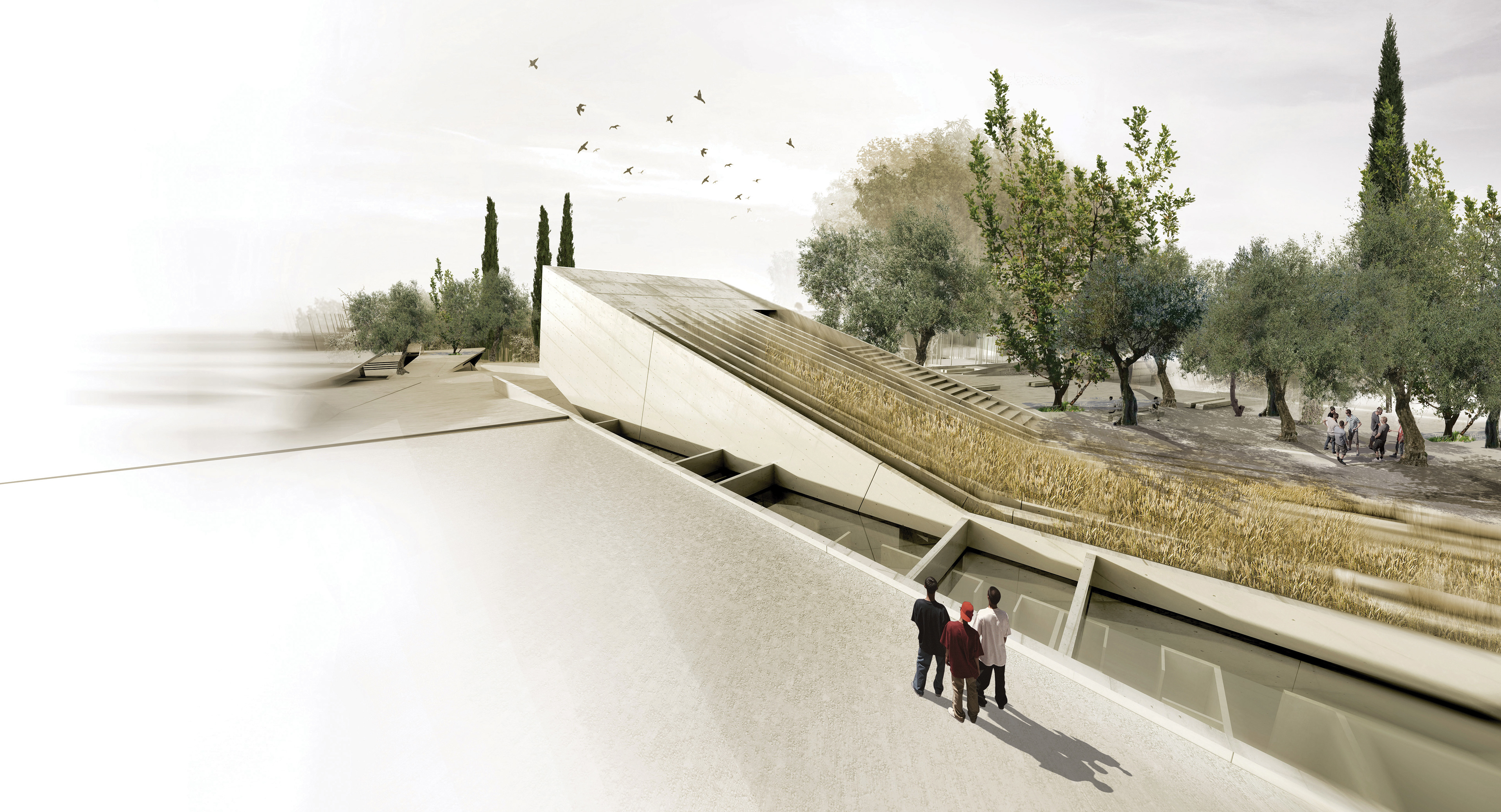
The character of the landscape and its rhythm have set the meter, the expression and the “economy” of the composite gestures produced by the buildings. In consequence, through clear and simple geometries, the buildings serve as a continuance of the ground; they are assimilated by it, showcasing the earthy character of the solution, leaving the field open, thus allowing the eye to swipe freely the entire expanse of the subject.
In addition, through subtle interventions to the ground relief, the entrances of the buildings serve as hoppers where outdoor movements terminate. As a result, the connection of the indoor with the outdoor area is slow, continuous, gradual and smooth, since the indoor is the natural continuance of the outdoor.
.
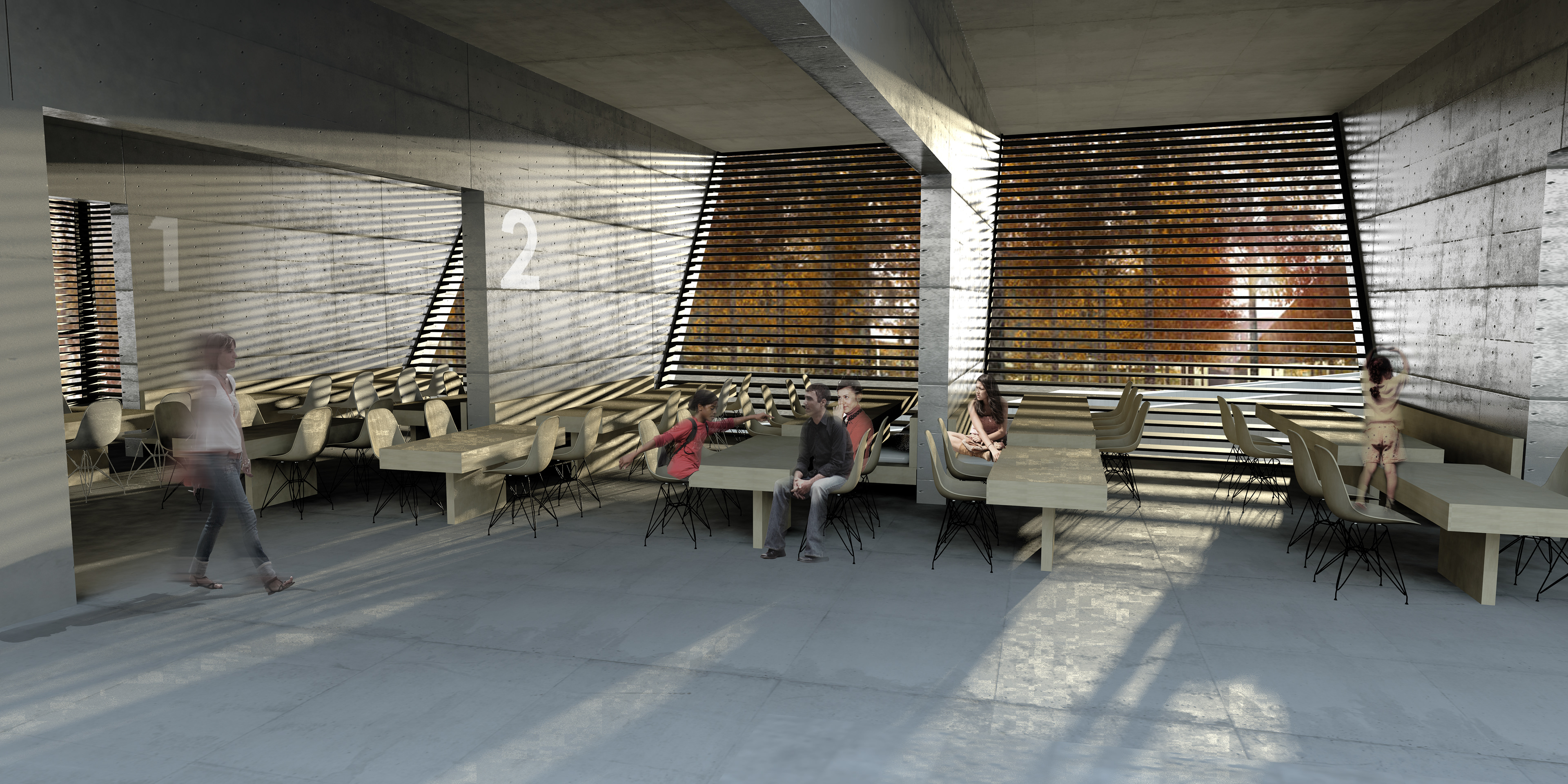
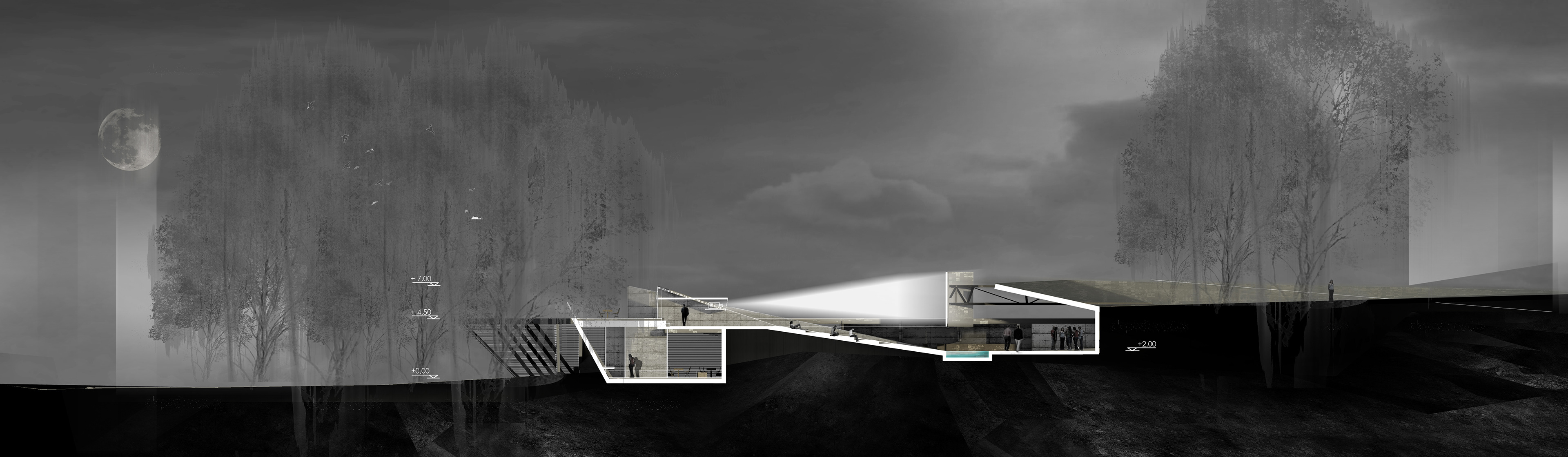
The relation between the inside and the outside is expressed as an effort for the outside to communicate with the built area. The separation of their boundaries is purposefully indiscernible. The correlations existing between them are constantly redefined, where the outdoor area of the park becomes an extension to the indoor area and vice versa. Specifically, the roof of the café - restaurant, together with the area of the cinema, located at its extension, serves as the central square, busting with life during the day and in the winter months. The same applies to the Centre for Environmental Awareness (C.E.A.), where the sloping surface of the entrance also serves as an amphitheatre, while in the back side of the roof spread planting strips, which could become a part of a wider environmental activity, drawing the interest of children in plant cultivation. In consequence, the areas of the park are not deserted after temporary uses, but remain constantly active. This way, the uses change and various incompatible activities interact with each other, creating spatial qualities that diversify in time.
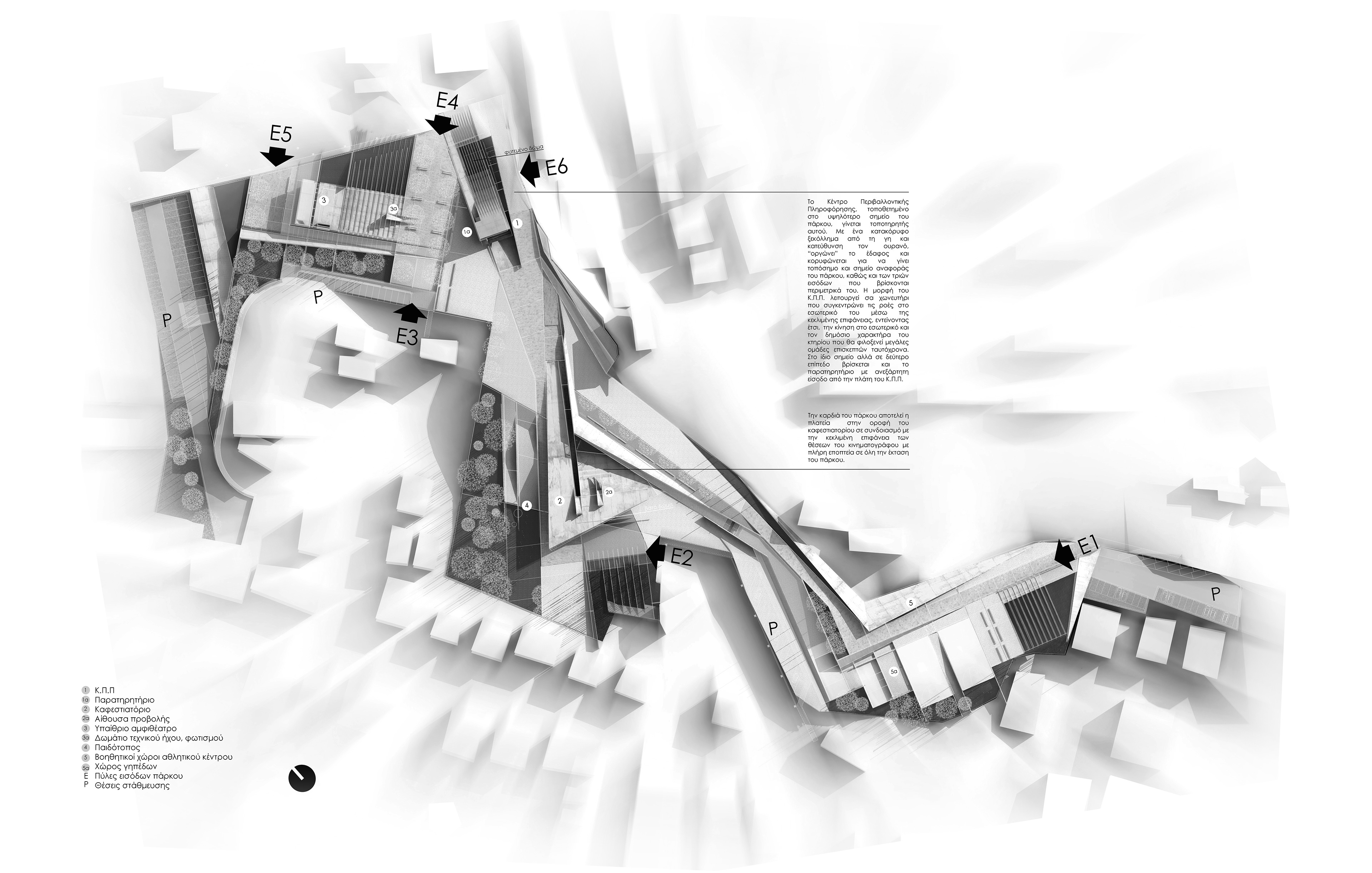
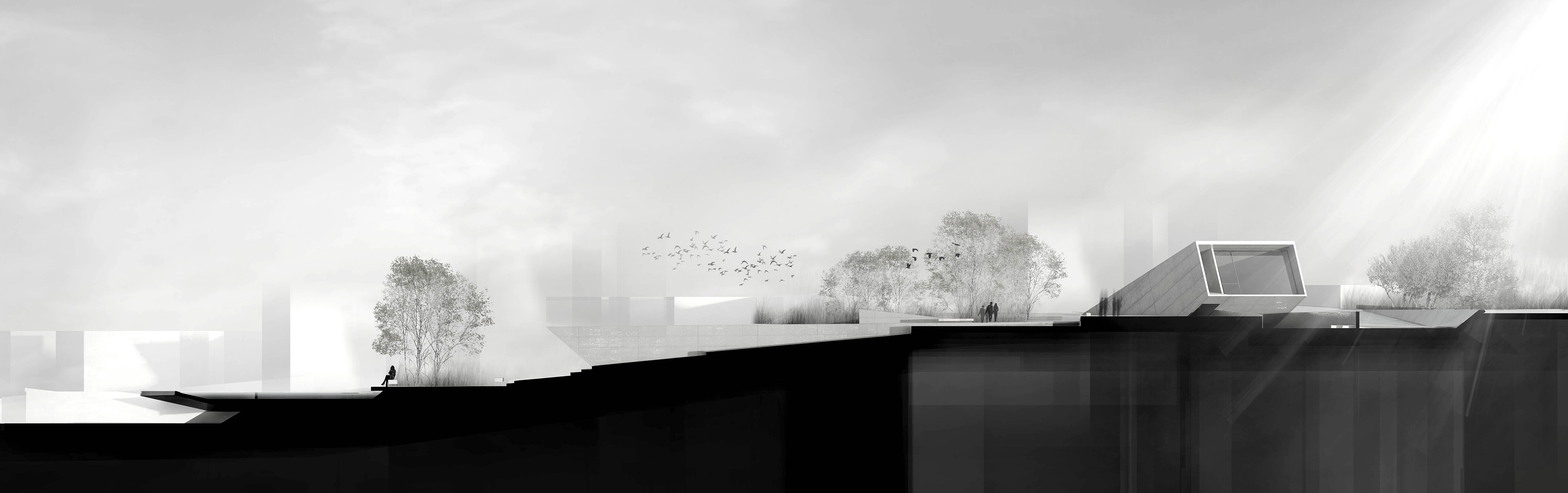
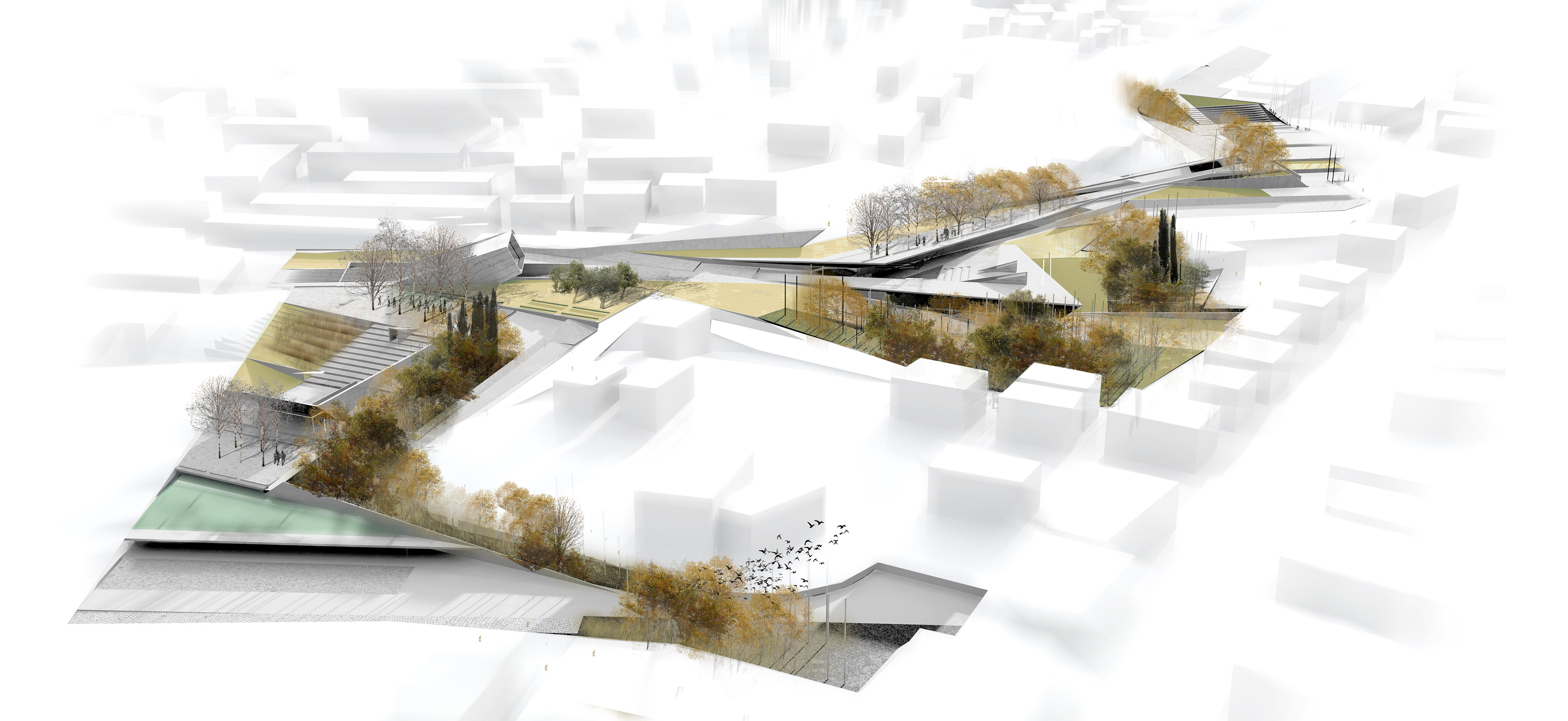
Following the dynamic of a simple gesture, the C.E.A. is elevated to become the focal point of the park. Its terrace, like ploughed land on the park’s skin becomes one with the ground, allowing the building to integrate with the park’s topography. At the rear side of the C.E.A., an elongated independent route leads to the observatory, located at the terminal point of the building, hence to its highest point. Close to the Centre for Environmental Awareness, there is the outdoor amphitheatre following the intense slope of the ground.
Utilising the advantageous topographical traits and the specific morphological and climatic characteristics of the location, the objective was to make use of the available environmental sources, such as the sun, the air, the water, and the soil.
All buildings and the sports centre are oriented towards the south, while the open areas created from this design take advantage of the west and southwest winds, which are so beneficial during the summer months.
Taking advantage of the intense inclination of the soil, we gather rainwater in subterranean reservoirs in the park, which shall be used for irrigation and cooling. Thin layers of water in central open areas contribute to air cooling through evaporation, while also covering part of the noise pollution.